12 great walking tracks from and around Riverglade CP
Whether you’re setting out from the Caravan Park, or folding your walk into a day’s drive, you’ll experience the beautiful scenery of the Kosciuszko region.
Please note: Whenever walking in the region you must take appropriate precautions: plenty of food and water, layers of warm/waterproof clothing, even in Summer. You can hire a Personal Locator Beacon (PLB) from Tumut Visitor Information Centre.
Please install the “Emergency” App on your phone, but please note, in some areas, phone coverage may be patchy.
For more information please contact Tumut Bushwalkers Club, Mr Ron Pearce 04399 91632 or Tumut Visitor Information Centre 02 69 477025
Walk 1: Tumut Wetlands
2 Kms return (loop) Easy
ABOUT THE WETLANDS: An area of approximately 20 hectares of wetland habitats, Tumut wetlands delivers amazing birdwatching, and beatutiful scenery across its series of lagoons. Fringed by native reeds, stands of the giant River Red Gum forests and the Tumut River flowing steadily along the east of the site, the area is home to more than 70 different bird species and are a must see for bird watching.
Waterbirds such as the Spotless Crake, the Darter, the Royal Spoonbill, the Cattle Egret, the Curlew Sandpiper, the Rufous Night Heron, the Australian Shoveler and the little Grassbird call the wetlands home. Keep an eye (or your binoculars) out for the White-bellied Sea-Eagle, the Wedge-tailed Eagle, the Peregrine Falcon and the beautiful Australian King Parrot.
GETTING THERE: From Riverglade Caravan Park (Site 21) take the dirt path along the Tumut River and wind your way along the river and lagoon.
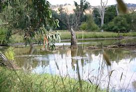
Tumut wetlands. A short walk from Riverglade Caravan Park to this timeless location
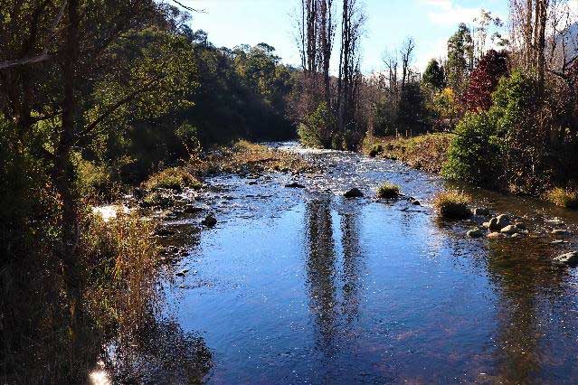
Walk 2 : Tumut River Walk
From Riverglade. 4 kms return. Easy
From the entrance to Riverglade Caravan Park, just near the Tumut Valley Canoe Club, walk along the sealed path going under Wee Jasper Road and meander along the Tumut River to the Tumut Turf Club. Stop in here at Harvest café. Along the walk veer off to the Labyrinth, duck pond, children’s playground & BBQ area.
Note – travelling with your four-legged friends? Bila Park is a leash-free dog area with Amenities

Prepare for views like this along the beautiful Tumut River Walk.
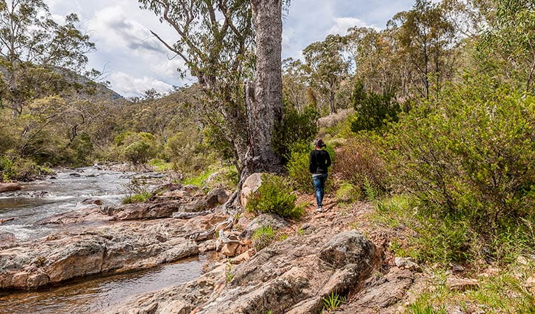
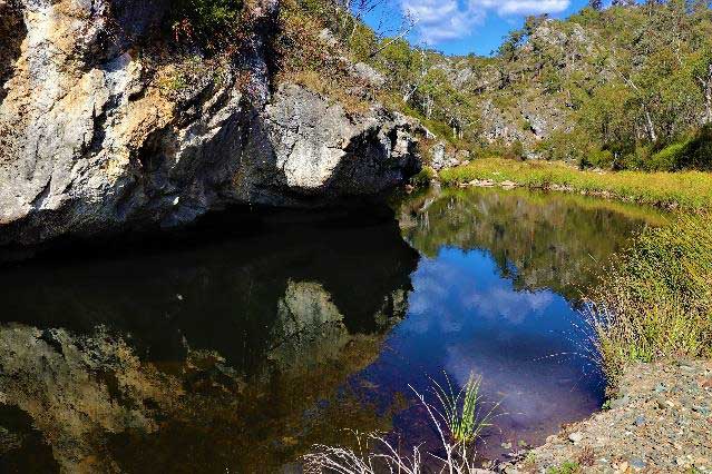
Walk 3 : Jounama Creek
Drive 40km, then 4 kms return walk. Medium/ Easy
Drive along Snowy Mountains Highway for approx. 40kms to Talbingo (on right), instead of turning right to Talbingo take gravel road on the left off the highway.
Drive in about 1km and leave your car. The walk starts at the camping area 500m off the highway.
From the camping area walk 1km to the end of the gravel road where the walk begins. It runs parallel to the creek and ends at a large pool.
For great views, follow the road and water pipe up to the source of the Talbingo water supply

A lovely walking trail approx 40 k from the Riverglade Park, Jounama Creek was affected by fire in 2019/2020. You’ll notice some residual changes to the landscape, as well as signs of recovery. Some areas may remain closed for longer to allow habitat to recover or because the park infrastructure is under repair
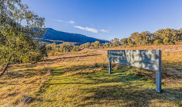
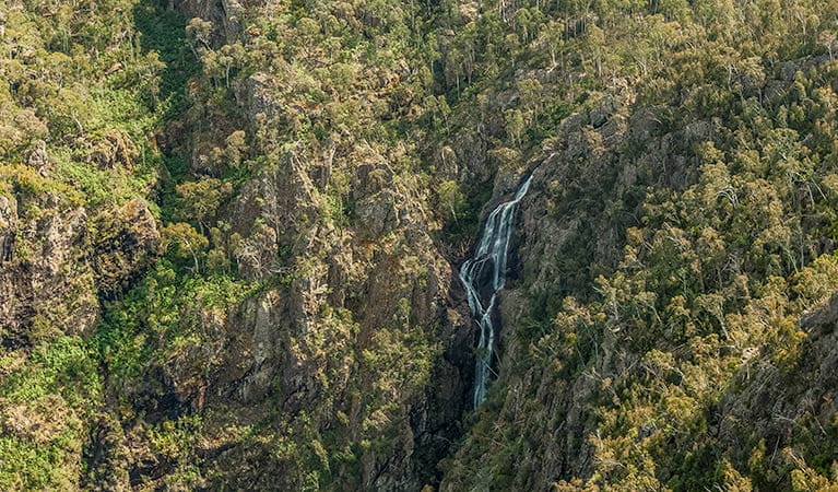
Walk 4 : Blowering Cliffs Walk
Drive 16km, then 8.5 Kms return walk. Medium/Hard
Fabulous views over Blowering Dam and the Dam Wall
Drive along Snowy Mountains Highway for 16kms and turn left at the Log Bridge Creek turnoff. Travel along a sealed road 500m & park the car just before crossing the bridge.
Blowering Cliffs Walk is approx. 3 hours return with good views over Blowering Dam. Steep in sections with scenic, ever-changing views of the dam, Blowering Cliffs walking track winds through open montane forest, which grows on sheltered hillsides.
You’ll enjoy views of the cliffs and waterfalls and it’s common to spot eastern grey kangaroos, emus and wallabies. Birdwatchers should catch sight of a range of native woodland birds, including honeyeaters, firetails, parrots and raptors.
The Blowering Cliffs tower above the track
For more about Blowering Dam, Ken Warby’s water speed record and the Snowy Hydro Project, read our blog
Blowering Cliffs Walk is approx. 3 hours return with good views over Blowering Dam
Walk 5 : Old Mountain Road Walk
Drive 45km, then 4 kms return walk. Medium/Easy
Drive along Snowy Mountains Highway for approx. 40kms toward the Talbingo turnoff on the right. Continue past this turn off, and start climbing a winding road for approx. 5kms. Note an RTA stockpile on the left of the highway (do not stop halfway up at the first Old Mountain Road sign as this is the middle of the track). The first part of the walk provides excellent views of the Bogong peaks and Jounama Creek valley.
After about 2kms the track turns sharp right and descends 350m in altitude to Jounama Creek. Turn left at the creek and walk along the Jounama Creek.
The Old Mountain Road is Talbingo Mountain’s first road, built in 1860 during the Kiandra gold rush. Today, the only traffic you’re likely to see is a colourful variety of birdlife, including yellow-tailed black cockatoos, wallabies and eastern grey kangaroos. In summer, wildflowers such as purple kunzea and white-flowered tea tree bloom on the lower slopes.
The Old Mountain Road is Talbingo Mountain’s first road, built in 1860 during the Kiandra gold rush.
Walk 6 : Miller’s Hut
Drive 96km, then 4 kms return walk. Easy
Drive along Snowy Mountains Highway approx 96kms and turn right onto Long Plain Road then turn right onto Port Phillip Fire Trail.
Cross the Murrumbidgee River and when you get to the next creek crossing park the car and walk south approx. 1km. A foot pad goes south for about 2km – return the same way.
Follow the western side of Bally Creek, cross another small creek and up through the trees you’ll find Miller’s Hut (about 1km from Port Phillip trail)
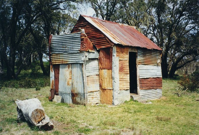
Millers Hut, one of the many huts dotted across the Kosciuszko region, was built in 1943 for grazing, using materials from a nearby ruin.
Walk 7 : Cliffords Fire Trail
Drive 25km. Medium walk
Drive for 25kms along Snowy Mountains Highway, park at Hume’s Crossing on the right (signposted).
Walk back across the highway and follow the track up across open grassland and into woodland.
After the first hill you’ll see a beautiful hidden valley with creek lines and the trail keeps going heading up into the mountains with views over Blowering Dam.
Walk 8 : Warogong Sugarloaf Walk
Drive 16km. 11 km return walk. Medium
Drive along Snowy Mountains Highway approx. 16kms to the turn off on the left and park the car. Walk approx. 2kms where the path branches to the right and takes you to a lookout on Bald Hill.
Further along the track there are extensive views over the Tumut valley to the north and Blowering Reservoir to the south west.
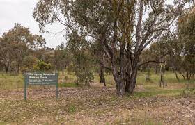
Waragong Sugarloaf walking trail delivers extensive views across the Tumut valley and does include some steep sections
Walk 9: Venables Hut
22kms drive, 10 km walk. Easy
A stunning, picturesque drive along the river
Take Wee Jasper Road and then travel along Lacmalac Road & Goobarragandra Road for approx. 22kms past the Hume & Hovell Track/Thomas Boyd Trackhead camp area and after another 5kms Rock Flat Camp area, a fabulous picnic/swimming spot. Continue 1km through an entrance which looks like the end of the road, but is a public road (Elm Grove Mountain Retreat). Continue to Macs Crossing, where the road crosses the river and where you can park the car.
Take the trail to the left past a farmhouse – not the track on the right up the hill.
Walk 4.5kms to the locked gate and a further 500m to the hut.
Mac’s Crossing
Macs Crossing
Walk 10: Landers Creek Falls
approx 50km drive then 12 Kms return walk. Medium/Hard
Carpark is accessible by 4wd. Gate to carpark is closed in winter and bad weather.
Drive along Snowy Mountains Highway for approx 50.7kms. Turn off the highway on right at Cumberland Trail & drive 4.7 km to carpark. Walk 1km to the first viewing platform, then a further 1km to second viewing platform – for spectacular waterfall and views.
Landers Falls lookout walk: dramatic views of Landers Creek waterfall plunging into the rocky gorge above Talbingo Reservoir.
Walk 11: Yan’s Crossing
Approx 64 km drive. 5 km return walk. Medium
Drive along Snowy Mountains Highway for approx 63.6kms and cross over Yarrangobilly River at Yarrangobilly Village Campground. Continue 1.4km and the entrance to the start of the fire trail on the right.
Drive 500m to the gate and park the car.
Walk continuously down hill until you reach Yarrangobilly River at Yan’s Crossing
Yan’s Crossing
Walk 12: Vickery’s Hut
Approx 50km drive. 4 kms return walk. Medium
Drive along Snowy Mountains Highway for approx.50.7 kms. Turn off the highway just past the Cumberland Trail turnoff. Walk 0.4km along Prosses Trail and then turn to the left. Go down about 2kms and cross Jounama Creek to Vickery’s Hut. Steep walk coming back up the hill on the return trip
NB: you will have to walk through a creek and should not be attempted after heavy rain.